Friday, 10 May 2013

Notes on field work in La Palma, Canarias.

From April 25th to 30th, I visited the Moveclim monitoring plots on the island of La Palma, Canaries, Spain. The collecting on the bryophytes has already mostly been done a couple of weeks before, and so I joined the research team of Juana, Raquel and Julio while installing data loggers and sampling the bryophytes at two remaining sites.
Vanderporten et al. (2007) list 53 of fern species for the Canary islands, of which about 35 may be found on La Palma. Within the plots of the project, I found in total 13 species, of which Asplenium onopteris and Dryopteris oligodonta have been the most frequent species and found in almost the half of the plots.


Figure 1  Photographs of selected plots from each elevation. Plot number and elevation is given. 

Species richness trend 
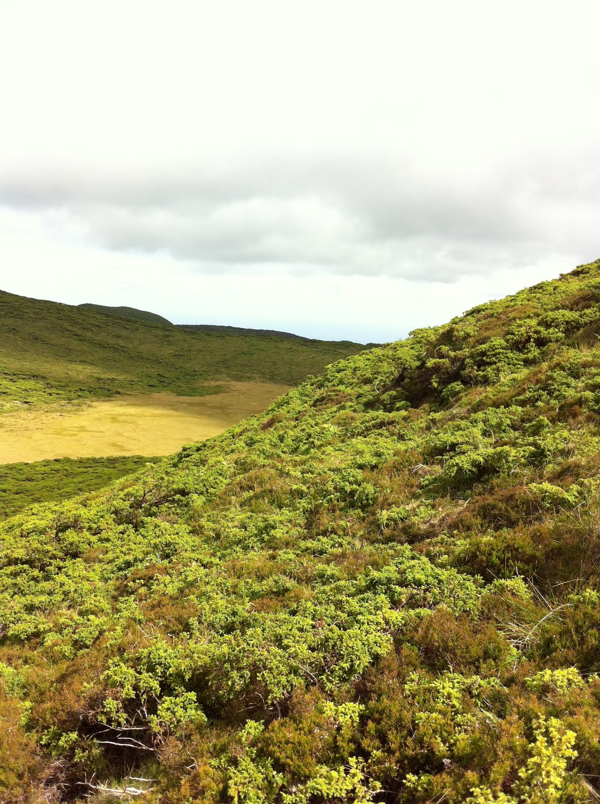
with elevation is as expected: at shady sites with Laurus canariensis, Ocotea foetens and other laurel species (monteverde) species richness is highest, creating the well known hump around 800 m (see photos of plots 400-1000 m in Fig. 1). This is also favoured by the fact that plots are situated in a deep erosion gully (barranco) with almost perennial running water. Towards lower and higher elevations, fern richness, as well as number of individuals per plot is reduced for similar reasons: drought. Below, at the hot and dry sites of the succulent vegetation and at the transition to monteverde-forest  (photo from 50 m in Fig. 1) with numerous Euphorbia-species and Opuntia, and at the transition to monteverde-forest (photo from 200 m in Fig. 1) only drought resisting species like Adiantum reniforme, Cheilanthes pulchella, and Davallia canariensis could be found sheltered between rocks in deeper shade. Above monteverde-forests, in Pinus-forests  (photos from 1400 m and 1600 m in Fig. 1), increasingly thick carpets of pine needles up to 20 cm and reduced ambient humidity prevent raise of most fern species, here as well restricted to sheltered situations between rocks (Asplenium adiantum-nigrum, Cystopteris diaphana) or as indicator after burning with subterranean rhizomes, Pteridium aquilinum susp. aquilinum (photo from 1400 m, with ca. 10-years-burned Pinus and Myrica faya). Asplenium adiantum-nigrum and Cystopteris diaphana are the only two species found at and above treeline in open habitats, again only between rocks in shrub-vegetation dominated by Adenocarpus viscosusPhotos of most species may be found in Fig. 3.

Juergen Kluge, University of Marburg (Germany)


Figure 2  Photographs of selected species from study plots. First row: Cheilanthes pulchella,  Adiantum reniforme, Davallia canariensis, Asplenium hemionitis, Cystopteris diaphana; mid row: Dryopteris oligodonta, Diplazium caudatum, Woodwardia radicans; bottom row: Asplenium onopteris, Polystichum setiferum, Pteridium aquilinum.


References
Vanderpoorten, A., Rumsey, F.J., Carine, M.A. 2007. Does Macaronesia exist? Conflicting signal in the bryophyte and pteridophyte floras. Am J Bot 94:625-639.
Read more ...

Monday, 22 April 2013

Revisiting the Piton des Neiges transect

A team of four people, O. Flores, P. Stamenoff who kindly joined the project for the occasion and two friendly volunteer assistants, A. Déléage and N. Gueroni, climbed the Piton des Neiges volcano beginning of April 2013. 
The objectives were : (i) recover the data collected by the climatic sensors in the upper part of the transect (1750 - 2950 m), (ii) bring the sensors back to the lab to assess the need for recalibration and recalibrate them in case, and (iii) re-set two sensors up. Indeed, during a former mission, we sadly discovered that one had been damaged and another stolen... 
 We started with a nice weather on Thursday morning at about 1500 m and collected data of four sensors on the way up. After an early wake-up, we then climbed the last part of the transect above 2500 m in a cold and rainy weather, but eventually succeeded in setting the upper sensors up and keeping all our fingers alive.
The new data will complete the description of climate on the sampling sites. We've noticed however some noise in the collected data, which could be due to low battery or drift after a too long period without calibration. Further enquiry required...

On the (steep) way up

Read more ...

Tuesday, 26 March 2013

News from the field...

        Despite three months of almost continuous rains between January and March 2013 in Tahiti, we were able to conduct several field surveys between 900 and 1400 m elevation in dense montane cloudforest with my assistant Maruiti TEROROTUA (Délégation à la Recherche de la Polynésie française) to find suitable locations to set up a series of 10 x10 m permanent plots. Because of the rough topography at that elevation range, with often steep slopes and deep narrow gulches, it was not feasible to set up larger plots (e.g. 20 x 20 m), and the choice of two 100 m² plots (one located in the upper part of the gulch, the other in the lower part) appeared to be the best option.

Photo 1: a view of a gulch in montane cloud forest between 1200 and 1300 m elevation


With the recent (the 17th of March) arrival of Pauline BLANCHARD, a graduate student (Master 2 Recherche) from the Université Pierre et Marie Curie of Paris 6, our small team started the following measurements in this series of permanent plots:
(1)  a complete inventory of all vascular plants, according to three main vegetation strata (canopy or tree layer > 5 m, understorey or shrub layer between 1-5 m and herbaceous layer < 1 m), including fern species found in different microhabitats (terrestrial on the ground, dead wood and logs, rocks; and epiphytes below 2 m, above 2 m, and found in the canopy),
(2)  the basal area of all woody species (diameter at breast height of all stems above 1,3 m) to describe the forest structure and composition, and assess the dominance of native (endemic and indigenous) versus alien naturalized woody shrubs and trees.

We have also decided to set up 2x2m quadrats around the 10x10 m permanent plots (for a total of 24 quadrats) to estimate the abundance of fern species by counting the number of individuals (or patches) per species and estimating their ground cover (%) in each quadrat. This protocol has both the advantage to prevent human disturbances inside the permanent plot, and increases our sampling area for fern diversity from 200 m² to 392 m² in each site.


 Photo 2: Pauline and Maruiti assessing fern diversity and abundance in 2x2 m quadrats (delimited by 2 m long woody sticks) located around the 10x10 m permanent plot (delimited by measuring tapes) set up at about 600 m in a Miconia invaded rainforest.


The most difficult part will be to set up similar plots above 1400 m (two hours hike both way) up to the summit of Mt Aorai at about 2000 m (overnight camping) !

Jean-Yves MEYER
Délégation à la Recherche de la Polynésie française

Read more ...

Tuesday, 20 November 2012

IUCN Red List of Bryophytes in islands

Bryophytes as small-sized plants are usually neglected by conservation efforts. The number of regional IUCN Red lists for bryophytes is also low compared to vascular plants. There is an increasing awareness that the vast majority of extinctions go unnoticed because they occur within small, highly neglected organisms despite representing the highest proportion of currently described species (Cardoso et al., 2011).

In her recent paper, Juana González-Mancebo (Moveclim Partner) and co-authors discussed the application of IUCN criteria to bryophytes in small and highly environmental diverse island systems and reported the first Red List for bryophytes of the Canaries which comprises 105 species. They concluded that the priority conservation should be given to freshwater habitats and cloud forests because both environments together contain 63 % of the endangered (EN) bryophytes in the Canaries.

González-Mancebo et al. 2012. Applying the IUCN Red List criteria to small-sized plants on oceanic islands: conservation implications for threatened bryophytes in the Canary Islands. Biodiversity and Conservation 21:3613–3636

Claudine Ah-Peng (Moveclim co-coordinator) and co-authors provided early this year the first IUCN Red List for Réunion (Mascarenes) liverworts and hornworts, 39 taxa of liverworts are threatened of near threatened with one species considered as regionally extinct. In Réunion, the threats that the bryoflora encounters are mainly due to human population growth leading to urbanization, habitat degradation, destruction and loss, clearing of native forest for cattle farming in the uplands and more recently moss harvesting for horticultural purposes.

Ah-Peng et al. 2012. Bryophyte Red List of Réunion (Mascarene archipelago): liverworts and hornworts. Phytotaxa 68:1-23

Based on these two recent initiatives,  a solid ground in the methodology of creating regional Red List for bryophytes is provided, which should be propagated to other oceanic islands and archipelagoes across the oceans, as IUCN Red List remain a practical tool for conservation efforts and native island systems are endangered. Locally in each archipelago, it is hoped that biodiversity managers will make use of these regional Red lists and will include bryophytes for setting the next conservation priorities.


Read more ...

Friday, 26 October 2012

Field trip in Canarias, La Palma island in October 2012

A trip to La Palma Island took place this month to work along the elevational gradient that is located in the eastern slope of the island. The team was composed by Pr. Dr. Juana María González Mancebo, Raquel Hernández Hernández and Julio Leal Pérez that is the collaborator of La Laguna Bryologists group.

Pix: La Palma's team during the field work of october 2012, from left to right, Raquel Hernández-Hernández, Julio Leal and Juana María González-Mancebo


The transect includes 24 plots from 40 to 2200 m a.s.l., among them 18 plots were made in this expedition.
Here it is a brief description and some pictures of the plots that were sampled.

40 m – Fajana de La Galga
Vegetation is mainly composed by coastal shrubs like Peripoloco laevigata, Euphorbia canariensis and Rumex lunaria. Bryophytes were more frequent in soil and rocks, although the cover was very reduced. The dominant species were Tortella nitida, Bryum spp. and Frullania ericoides.


Pix 2: Raquel and Julio working in Fajana de la Galga


200 m- Barranco del Cubo de La Galga
The dominant tree species at this elevation were Apollonias barbujana and Visnea mocanera, so thermophilous laurel forest trees. Canopy is quite closed, so we found a higher bryophyte cover and species like Homalia webbiana, Radula lindenbergiana, Eurhynchium meridionale.

Pix 3: Raquel and Juana María working at 400 m in the first forests along the elevational gradient

400 m- Cubo de La Galga

The canopy at this elevation was mainly dominated by Laurus novocanariensis and Persea indica. Some exotic herbaceous species were also present and unfortunately relatively abundant like Ageratina adenophora. Bryophytes were way more abundant in rocks (75%) than in other microhábitats.


600 m- Cubo de La Galga
Laurel forest dominated by Persea indica and Ocotea foetens. Bryophytes cover increases highly respect the previous elevational plots. The most common species were the Iberian-Macaronesian endemic Heteroscyphus denticulatus and a widespread species in the laurel forest, Isothecium myosuroides, mainly in rocks.

800m- Barranco de Los Tilos
Forest dominated by Persea indica and Laurus novocanariensis. Total canopy cover reaches 95%. Dominant bryophytes were: Rhynchostegium megapolitanum, Saccogyna viticulosa and Frullania tamarisci.

Pix 4: Plot in the Laurel forests in Barranco de Los Tilos

1000m- Pista del Mulato (Barranco de Los Tilos)
Laurel forest composed mainly by Laurus novocanariensis, but there were also presence of Persea indica, Morella faya and Ilex canariensis. Some of the species we found were Saccogyna viticulosa, Isothecium myosuroides and the Macaronesian endemic Leptodon longisetus.

1200m- Under the “Casa del Monte” (Barranco de Los Tilos)
Laurel forest in which Laurus novocanariensis is the dominant species together with some individuals of Erica arborea and Ilex canariensis and with a narrow closed canopy. Bryophytes cover on rocks raised 80%.

1400m- Casa del Monte (Barranco de Los Tilos)
Mixed pine forest dominated by Pinus canariensis, Morella faya and Erica arborea and Pinus canariensis. The total canopy cover is 80%. Bryophytes very scarce and only present on soil under the pine litter.

1800m- Topo Mosquito
This correspond with the highest plot with pine forest in our transect.  At this elevation the schrub Adenocarpus viscosus was quite abundant. Bryophytes relatively abundant (45%) on rocks, but absent on soils and very scarce as epiphytes (only Dicranoweissia cirrata and Orthotrichum sp. On rocks Grimmia trichophylla was the most common species.


Pix 5: The highest level for the pine forest in La Palma is around 2000 m a.s.l.

2000m- Fuente Vizcaína

Schrub-land vegetation dominated by Adenocarpus viscosus, with presence of other species like Erysimum scoparium and some graminae species. Bryophytes only present on rocks.


Pix 6: High montane vegetation in La Palma at 2000 m a.s.l.

Some additional work

In this island two additional transects are being studied at the same altitudinal level. Both are transects with a different degree of disturbance as part of the thesis of the PhD of Raquel Hernández-Hernández, in which we are trying to analyse the influence of disturbance along the elevation gradient on both, biodiversity and functional traits of bryophytes.  


Text and Photographs: Juana María González-Mancebo


Read more ...

Monday, 15 October 2012

On the use of "elevation" and "altitude"

In a recent paper Vicar & Körner (2012) in  Oecologia (doi:10.1007/s00442-012-2416-7)  clarified the use of elevation, altitude and height that have been used with confusion in literature. Here, I report from their note the definition of these terms, which sometimes have been misused from translations between Romanic languages.

Elevation is the vertical distance between  a point on the land surface and a reference point, usually taken to be the mean sea level.
Altitude is the vertical distance between an object (e.g., a bird, aircraft, or parcel of air) and a reference point or stratum, where the object is not in direct contact with the reference point/stratum.
Height is the vertical distance between the top of an object and the land surface, where the object is in direct contact with the ground.

I thought some of you will be interested...
Read more ...

Monday, 1 October 2012

Field trip in Azores, Terceira island: 25-28th september 2012

An expedition in Terceira island (Azores)  along an elevational gradient took place between the 25th and 28th of September 2012. The team was composed by Pr. Dr. Rosalina Gabriel, Márcia Coelho, Raquel Hernández, Débora Henriques and by Fernando Pereira.
This study of this gradient in the Azores is carried out in the framework of Débora’s PhD (University of Azores). Raquel (PhD student in Canaries) joined the Azorean team to be trained on the collecting methodology of the Moveclim project.
The weather was good, allowing the fieldwork to proceed within 4 days. Six altitudes were sampled along the gradient from 40 to 1000 m. This transect was set up along the western side of the island.
We briefly describe here the sampling sites and illustrate the gradient with some photographs:
40 m – Serreta lighthouse
Vegetation is composed of shrubs (scrubland). Bryophytes are more abundant on rocks, the canopy is low < 2m. The vascular flora is dominated by Erica azorica and Myrica faya.

Pix: Vegetation type of the lowland (M. Coelho)

200 m – Canada das Covas – Serreta
The forest was unfortunately dominated by non-native Pittosporum undulatum, but also by native trees like Erica azorica and Myrica faya
Pix: Bryophytes were there mainly recorded on the rocks ( R. Gabriel)

400 m – Pico Carneiro - Serreta
Forest system, the canopy is higher (maximum of 6 m). Vegetation is dominated by Pittosporum undulatum (70%). Erica azorica, Juniperus brevifolia and Myrica faya were also present but in lower quantities (25-30%).
Pix: Raquel on the field in Pico Carneiro-Serrata (R. Gabriel)

600 m – Pico da Lagoinha – Serreta
Forest vegetation dominated by Laurus azorica (40%), Juniperus brevifolia (30%) and Ilex azorica (30%). Cover of bryophytes is predominant on the soil (100%) but also very significant in trees (75%).

800 m – Trail to Lagoa do Pinheiro - Serreta
Forest system with trees up to 4 m high. Juniperus brevifolia and Ilex azorica were the most frequent trees composing the native vegetation together with Laurus azorica and Vaccinium cylindraceum. Bryophytes were more common in the trees (95%) and in the soil (75%).
Pix: Sphagnum sp in Lagoa do Pinheiro-Serrata (M. Coelho)
1000 m –Serra de Santa Bárbara
Serra de Santa Bárbara is a Natural reserve of 1863 ha with the highest peak at 1021 m. The vegetation is dominated by scrubland; bryophyte cover is predominant on the soil and schrubs. Vascular species are < 2 m high. Juniperus brevifolia and Calluna vulgaris dominate the plant composition, Hymenophyllum sp. is also abundant.
Pix: Bazzania azorica and filmy ferns (R. Gabriel)

Pix: Vegetation type in Serra de Santa Barbara (M. Coelho)

Three other islands of the Azores will be explored along an elevational gradient in the framework of Débora's PhD thesis, the rest of the field work will take place in mid 2013. Samples of the Pico and Terceira gradients are now being curated and processed for analysis at the University of Azores.

Text and Photographs: Dr. Rosalina Gabriel, Márcia Coelho, Débora Henriques, Raquel Hernández.


Read more ...