Showing posts with label ferns. Show all posts

Tuesday, 28 July 2015

Scientific helicopter expedition to the top of the island of Tahiti, July 2015

A two-days field trip was organized by Jean-Yves Meyer from the Délégation à la Recherche (French Polynesian Department of Research) in collaboration with the local nature protection group « Te Rau Ati Ati aTau a Hiti Noa Tu » to Mont Orohena, the highest summit of the Tahiti reaching ca. 2250 m, which is also the highest peak of all the South Pacific islands.

Pete, Rava and Darko in a steep humid ravine (Photo: Jean Yves)
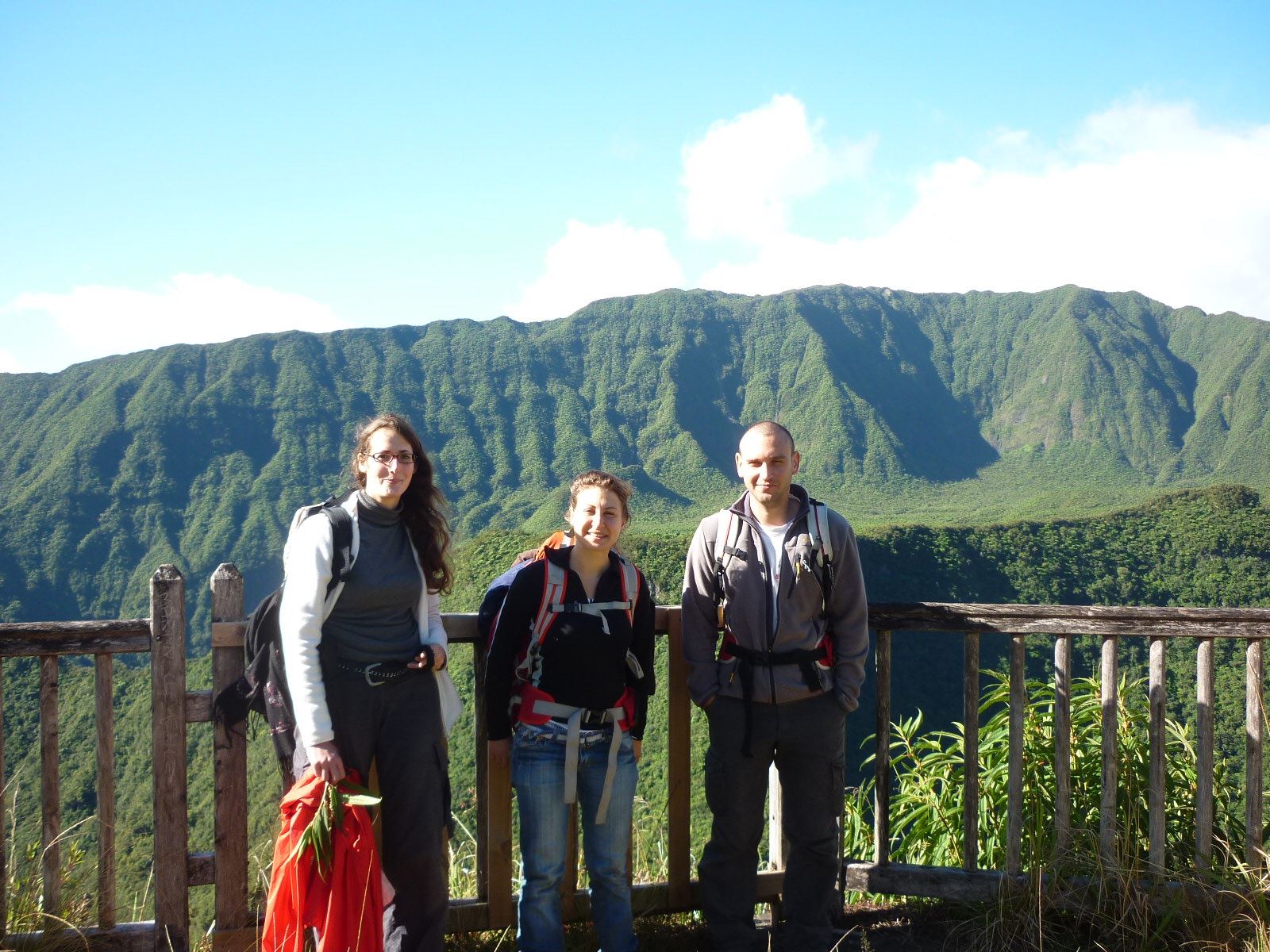
A team of eight people (including Ravahere Taputuarai, Henri Jay, Teva Maireau, Théo Guilloux and Maxime Chan from « Te Rau Ati Ati ») was dropped by the helicopter on the 24th of July 2015 to spend two days and one night, in order to complete the inventory of all Pteridophytes (ferns and allies) and Bryophytes (mosses, liverworts and hornworts) for the Moveclim Project, but also to collect moths and spiders with two visiting research scientists: Darko Cotoras, a Chilean post-doc sponsored by the California Academy of Science, and Pete Oboyski, the curator of the insect collection at the University of California at Berkeley. The helicopter trip was covered by a journalist from the daily magazine « Tahiti Infos » which is freely distributed as paper copies and also accessible online (http://www.tahiti-infos.com/Des-scientifiques-sur-le-toit-du-fenua_a132998.html) and on the press page of this blog.
Teva and Darko collecting on the summital ridge (Photo: Jean Yves Meyer)
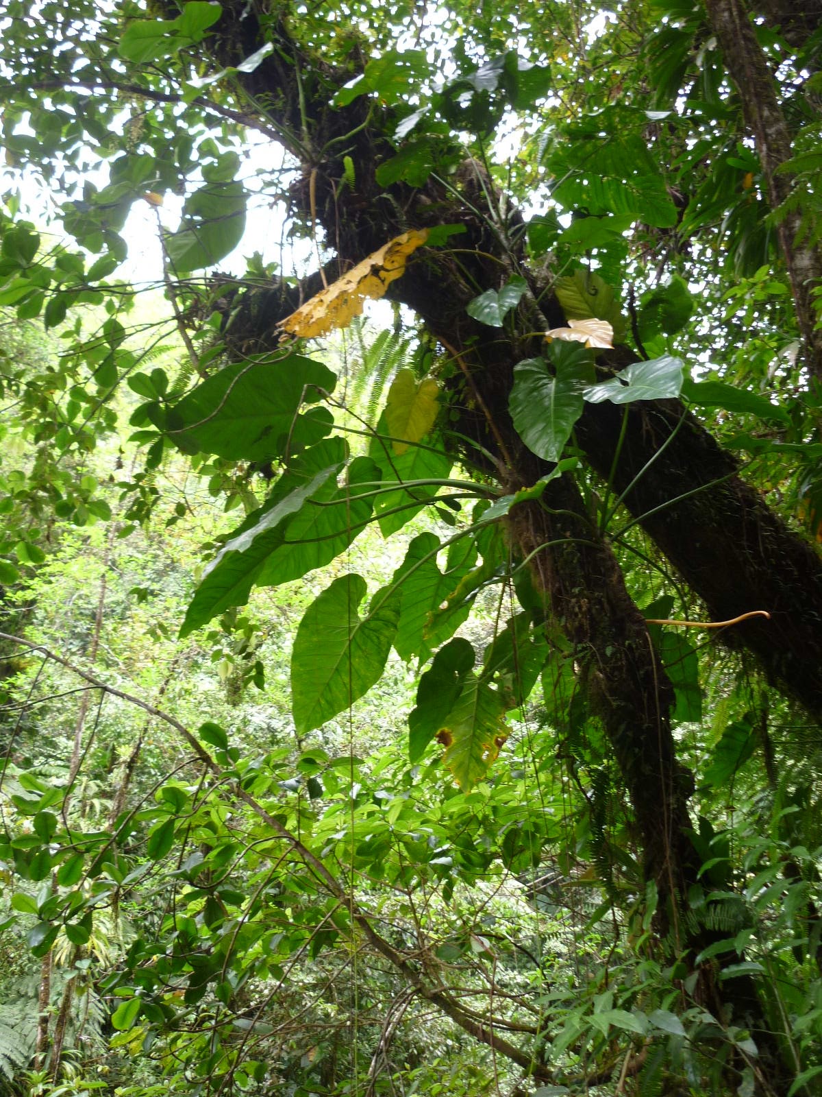
The collected ferns and moss specimens will complement the data obtained along the elevation gradient of Mt Aorai (between 600-2000 m) during the past 3 years. Field surveys were made on the main exposed ridges covered by dense shrublands and in some deep, wet and forested gulches on very steep slopes requiring sometimes a rope. Although no micro-climatic sensor was installed on Mt Orohena due to the very difficult access, temperature (measured with a mercury thermometer) decreased down to 3°C at night!

Team at camp (Photo: Jean Yves)
Summital peak, ridges and gulches (Darko Cotoras)


This expedition was the last one to be conducted in Tahiti for the Moveclim project, which will remain a great scientific and human adventure for the French Polynesian coordinators.

Jean Yves in the forest (Photo: Darko Cotoras)
Content: JYM
Photographs: JYM & DC
Read more ...

Friday, 12 July 2013

From the shore to the summit and from the "Moss" to the "Tree" on La Reunion island

We, Lolita and Lisa, conducted complementary studies on the eastern side of  Piton des Neiges in the National Park of La Réunion. Our hypotheses were built up on the data set from their first inventory in 2008. In the frame of our two master studies we, both, try to find explanations about the distribution of the plant species they found and therefore visited the plots together. However, our thesis are based on two different perspectives in ecology.


Lolita focuses on the large scale distribution of the three major plant groups (Bryophytes, Pteridophytes and Angiosperms) and investigates the effect of water use efficiency on their altitudinal distribution in La Réunion for her master at the University of Zürich.  

Lisa is doing her master thesis (Paris 6) on ecological factors affecting the vertical distribution of corticolous (=bark living organisms) bryophytes along an elevational gradient.  The hypothesis is that bryophytes have specific microhabitat determined by various abiotic factors (temperature, interception of sunlight and exposure of the area) and biotic (bark rugosity, tree species). Under the guidance of Claudine Ah-Peng we spent 14 days in the field from mid May to mid June 2013. It was a learning journey, discovering La Réunion in a deeper manner. We had a closer look on plant diversity and on plant distribution along an elevational gradient. Each altitude has its own characteristics, not only concerning the species composition but also vegetation structure.


 We stayed at Gite de la Bélouve few nights and at La Caverne Dufour for a couple of nights. Also, we climbed up the Piton des Neiges (3070 m) for our work as the highest plot is at 2950 m!

FIELDWORK
Lolita Ammann:

Liverworts, mosses, ferns and angiosperms have their diversity maxima at different elevations. The older the stem group, the higher lies its diversity maximum on the elevational gradient. In this study I test how much this pattern is determined by water use efficiency by making up three hypothesis:
-Water use efficiency should become higher in lower elevations considering the decrease in water availability towards lower elevations,
- Comparing humid and arid sides of mountains, the decrease of overall diversity on the arid side is more pronounced for groups with lower water use efficiency, 
On the sentier de la Rivière, Bélouve forest

- Comparing humid and arid sides of mountains, diversity patterns of the major plant groups are shifted upwards on the arid side because of higher cloud condensation levels and the increasing importance of low temperatures in determining environmental humidity.

Three approaches/methodologies should help me to assess the questions: for carbon isotope ratio (δ13C), samples of the 5 most representatives of the three stem groups are collected for both terricolous and epiphytic habitats, LICOR 6400 (gas exchange measurements, i.e., uptake of CO2 and release of water) these tests will be conducted in controlled greenhouse conditions, so collected plants needed to be transferred alive to Zürich, and finally comparison of the diversity pattern of fern and angiosperm species between the western and eastern transect.

Lisa Margot Couet:

We are currently aware that landscape feature creates microclimate. Therefore, we can suppose that bryophytes, being small organisms and living in a wide range of substrat have particular microhabitats. As any plants, bryophyte species have different light and temperature requirements. My work  focuses on factors affecting the corticolous microhabitats for bryophytes.
The hypothesis is that there is a smaller scale distribution and assemblage of species along the phorophyte.
Lisa measuring the temperature of the moss colony
In the field, I recorded data on three or four species of bryophytes at each altitude. We chose 15 trees per altitude which hosted at least one of the species studied and represented well the ecosystem. For each tree, I measured the size (length, width, thickness) of each colony, the temperature and the sunlight intercepted in each of the 3 microhabitats (0-0,5m; 0,5-1 m; 1-2 meters). I also recorded the tree species and their morphology (DBH, Height, Bark rugosity) in order to evaluate the influence of the substrat on the distribution.  
The leafy liverwort, Mastigophora diclados

I collected data for the following species: Mastigophora diclados (Brid. ex F.Weber) Nees), Pyrrhobryum spiniforme (Hedw.) Mitt., Dicranoloma billardierei (Brid.) Paris, Pleurozia gigantea (F. Weber) Lindb., Holomitrium borbonicum Besch., Herbertus dicranus (Taylor ex Gottsche, Lindenb. & Nees) Trevis., Leucophanes angustifolium (Renauld & Cardot ) and the two gender Bazzania and Radula.

luxmeter
   Describing ecological niches of corticolous bryophytes is a particular matter as some are referred as biological indicators. Knowing if a species is a generalist or a specialist across ecosystem can help to investigate on the impact of climate change at different scales. Also, as a complementary on bryophyte niches, I investigated the assemblage of a few common species and their distribution along the elevational gradient.


We had a great time exploring the montane tropical forests. Local botanists and ecologists who are involved in project within the park came to give us a hand in the field for the collection and the identification of plants. Furthermore, we were part of the team to set up the new transect in the Western side, at La Forêt des Makes, where sensors of temperature and relative humidity were set up every 200 m from 1150 to 2350 m. Many thanks to Jacques, Pierre, Olivier, Dominique S, Dominique H and in particularly Claudine Ah-Peng who take us in the field and take care of the organization of the field work.


Lolita, Lisa and Dominique H, Takamaka viewpoint


From left to right, Lisa, Claudine, Jacques and Lolita, 7th of June 2013, Bélouve forest


Read more ...

Friday, 10 May 2013

Notes on field work in La Palma, Canarias.

From April 25th to 30th, I visited the Moveclim monitoring plots on the island of La Palma, Canaries, Spain. The collecting on the bryophytes has already mostly been done a couple of weeks before, and so I joined the research team of Juana, Raquel and Julio while installing data loggers and sampling the bryophytes at two remaining sites.
Vanderporten et al. (2007) list 53 of fern species for the Canary islands, of which about 35 may be found on La Palma. Within the plots of the project, I found in total 13 species, of which Asplenium onopteris and Dryopteris oligodonta have been the most frequent species and found in almost the half of the plots.


Figure 1  Photographs of selected plots from each elevation. Plot number and elevation is given. 

Species richness trend with elevation is as expected: at shady sites with Laurus canariensis, Ocotea foetens and other laurel species (monteverde) species richness is highest, creating the well known hump around 800 m (see photos of plots 400-1000 m in Fig. 1). This is also favoured by the fact that plots are situated in a deep erosion gully (barranco) with almost perennial running water. Towards lower and higher elevations, fern richness, as well as number of individuals per plot is reduced for similar reasons: drought. Below, at the hot and dry sites of the succulent vegetation and at the transition to monteverde-forest  (photo from 50 m in Fig. 1) with numerous Euphorbia-species and Opuntia, and at the transition to monteverde-forest (photo from 200 m in Fig. 1) only drought resisting species like Adiantum reniforme, Cheilanthes pulchella, and Davallia canariensis could be found sheltered between rocks in deeper shade. Above monteverde-forests, in Pinus-forests  (photos from 1400 m and 1600 m in Fig. 1), increasingly thick carpets of pine needles up to 20 cm and reduced ambient humidity prevent raise of most fern species, here as well restricted to sheltered situations between rocks (Asplenium adiantum-nigrum, Cystopteris diaphana) or as indicator after burning with subterranean rhizomes, Pteridium aquilinum susp. aquilinum (photo from 1400 m, with ca. 10-years-burned Pinus and Myrica faya). Asplenium adiantum-nigrum and Cystopteris diaphana are the only two species found at and above treeline in open habitats, again only between rocks in shrub-vegetation dominated by Adenocarpus viscosusPhotos of most species may be found in Fig. 3.

Juergen Kluge, University of Marburg (Germany)


Figure 2  Photographs of selected species from study plots. First row: Cheilanthes pulchella,  Adiantum reniforme, Davallia canariensis, Asplenium hemionitis, Cystopteris diaphana; mid row: Dryopteris oligodonta, Diplazium caudatum, Woodwardia radicans; bottom row: Asplenium onopteris, Polystichum setiferum, Pteridium aquilinum.


References
Vanderpoorten, A., Rumsey, F.J., Carine, M.A. 2007. Does Macaronesia exist? Conflicting signal in the bryophyte and pteridophyte floras. Am J Bot 94:625-639.
Read more ...

Monday, 14 May 2012

Field Trip on La Soufrière volcano: 1-9 June 2012


MOVECLIM expedition in Guadeloupe from June 2nd to 9th 2012

The team included six people: Claudine Ah Peng and Olivier Flores (University of La Réunion), team leaders, Terry Hedderson (University of Cape Town), Juergen Kluge (University of Marburg), Jean-François Bernard and Elisabeth Lavocat Bernard (scientific council of the National Botanical Conservatory of Guadeloupe) as local partners.
The expedition consisted in establishing permanents plots for long term monitoring and characterizing bryophytes and ferns diversity along an altitudinal gradient on the Eastern slope of the volcano La Soufrière (1470 m) with elevational steps of 200 m, the lower step at 300 m and the higher at 1450 m.
From 450 m until 1450 m the plots were located in the National Park of Guadeloupe which issued our collecting permit.

Pix:  Transect study sites of La Soufrière volcano on Basse Terre (map O. Flores)


Elisabeth and Jean-François did a preliminary investigation for finding the plots in April and May, except for the plot 1050 m, which was a clusietum area (Clusia sp.) and needed to be discussed with collaborators to determine the site. Temperature and relative humidity loggers were set up on each studied plot and started at a recording time of every hour.
The climatic data will be, then recorded every six months by the National Park agents.

Friday June 1st
At the airport welcoming of the participants by Lisa, fetching of the rental car and drive to the rented house in Capesterre Belle Eau (Basse Terre).

Saturday June 2nd:
Plots at 650 m in the second Carbet Fall area, in a native rainforest.
Pix 1: Carbet Fall 

Pix 2: 650 m plot
Pix 3: Vegetation type at 650 m


Sunday June 3rd:
Plots at 850 m just below the first Carbet Fall, cloud forest with smaller trees with many epiphytes (bryophytes, ferns, bromeliaceae, orchids…) hanging from the branches.

Pix 4: Vegetation type at 850 m plots


Pix 5: Epiphytic Lepidozia reptens

Pix 6: Epiphylls, Lejeuneaceae ssp.


Monday June 4th:
Plots at 1450 m near the summit of La Soufrière and plots at 1250 m at the Pass of L’Échelle, just below the volcano with low-shrub vegetation.
Pix 7: Sphagnum sp.

Pix 8: Populations of Sphagnum sp on La Soufrière massif.
Pix 9: Pitcairnia sp.
Pix 10: Rhacocarpus purpurescens


Tuesday June 5th:
Plots at 1050 m in the clusietum. Moving around in this plot was difficult  due to dense low shrub vegetation, not easily penetrable.


Pix 11: In the Clusia sp. bush


Wednesday June 6th
Resting and curating specimens

Thursday June 7th
Plots at 450 m, just above third Carbet Fall, rainforest. At this elevational level, the National Park partners were informed to the usage of the loggers as it was planned in the Moveclim project.
In the evening, a meeting was held with the National Park partners where we discussed the project. Work of each partner was clarified as well as the most appropriate mode of involvement of National Park of Guadeloupe in this project.
Pix 12: Olivier & Alain, using the laser distance meter to measure the tree height

Pix 13: Vegetation type at 450 m

Pix 14: Setting up the plot of 10 X10 m


Friday 8th
Plots at 300 m, relatively slightly modified rain forest, on rocky soil. This plot is not located in the National Park area.
Pix 15: Vegetation type at 300 m


Saturday 9th
Departure to Paris and preparation of the kick off meeting.

Dr Alain Rousteau (University of Antilles Guyane) and Marion his PhD student were with us the last two days for collecting data about the vegetation structure of the plots (canopy height, tree species identification and diameter). Hervé Magnin (National Park of Guadeloupe) and his collaborator joined on a midday trip.

A very nice weather, a good understanding and cooperation between the partners with a very nice and friendly atmosphere made this mission very pleasant and successful as all sampling was efficiently done!

Authors: Elisabeth Lavocat Bernard and Jean-François Bernard

Photographs: C. Ah-Peng & E. Lavocat-Bernard


Read more ...