The international
conference “Vulnerable islands in the sky: management of tropical island
alpine and sub-alpine ecosystems” was hosted in Hawaii (Big Island), Waimea,
from August 4-7th 2012. The University of Hawaii at Hilo (UHH), the
office of Mauna Kea management and the Gordon and Betty Moore foundation
supported this conference.
Thirty
papers were presented and almost 50 people gathered at HPA Waimea for this
symposium. I report below some highlights of what we talked about; linking
science and management was central in the discussion.
Donald
Straney (UHH chancellor), in the welcoming remarks, highlighted the
responsibility of the university for managing these alpine mountain ecosystems
and the unique opportunity of gathering scientists of high islands in the world
for replicated systems.
Session 1:
Tropical Mountain Climate Change
In his introductory
talk “Losing the high ground: rapid transformation of tropical island alpine
and sub-alpine environments”, James Juvik and co-authors raised the fact that
the temperature inversion layer found in most oceanic islands with trade winds,
has a major impact on increasing aridity at the summit areas.
Pix: Sea of cloud on Mauna Loa (4170 m), from the trade wind inversion (TWI) layer
This phenomenon
has dramatic effect on the water balance of these high altitude ecosystems. Similarly,
Patrick Martin (Colorado University) showed for the Dominican Republic on a
10-year survey a rise of temperature and specifically an increase in the
frequency of the inversion temperature layer. From his HALENET network climatic
data sets (24 years recordings), Thomas W. Guimelluca (University of Hawaii,
Manoa) could enounce with confidence an increase of temperature in the future,
with less confidence a lower amount of precipitation, higher solar radiations
and less clouds.

Pix:
Climatic station on Mauna Kea
Consequences
of increased aridity is already noticeable on the flanks of Mauna Kea, Paul
Krushelnyky (University of Hawaii, Manoa) gave the example of climate
associated population declines of the iconic endemic silversword, associated
with continued warm and dry conditions added to damage by introduced ungulates
and human vandalism.
Pix :
Endangered silversword: Argyroxiphium sandwicense
ssp. macrocephalum on Mauna Kea
In his
talk, Henri F. Diaz (NOAA) specified that warmer oceans lead to enhance
hydrological cycle as an increase of latent heat input to the atmosphere. Data
from the last 80 years indicate enhanced upper elevation warming include a
reduction in the frequency of occurrence of freezing temperature in the upper
slopes of the higher terrain in Maui and Big island (Hawai’i archipelago).
Michael Prentice (Indiana University) and Geoffrey Hope (Australian National
University) supported this result, by reporting the glacier recession in Papua
and New Guinea provinces, as well as the sensitivity of the alpine vegetation
to climatic and anthropogenic disturbances. G. Hope highlighted the use of
paleoecology to reconstruct vegetation dynamics, also emphasized by Shelley
Crausbay (Colorado University) in session 2, on her study case on a glacier
Lake of Haleakala volcano in Hawai’i. To end the first session Wouter Buytaert
(Imperial College) gave an overview of the importance of tropical alpine
grasslands for ecosystem services including water supply, biodiversity and
carbon storage, with the example of the Paramó in the Andes.
Session 2:
Evolution in Mountain Environments
Oceanic
island summits offer a high degree of endemic species especially for plants.
Mountains act as islands within islands, for space that has been already
isolated. In his paper, Manuel Steinbauer (University of Bayreuth) related
space and the geological evolution of island archipelagos to the diversity of
high elevation ecosystems, and took the example of single island endemics,
which increase with elevation. José Maria Fernandez Palacios (University of La
Laguna) accentuated the effect of erosion (habitat history) on those sub-alpine
island ecosystems. José Maria reminded us that summit biota frequently displays
a very high endemism, which may originate from dispersal from other close
summit ecosystems during peak period (multiple summit endemics), when a
dispersal window remains open for pre-adapted summit biota, or more usually
from the colonisation of the summits and later evolution to the new conditions
from low or mid-altitude generalist species of the same island (single summit
endemics). In the “No Way Out” scenario, when peaks are absent, the
disappearance of summit ecosystem implies the extinction or extirpation of
their competitive species. Allen Allison (Bishop Museum) gave the only example on
animals, with the high altitude herpetofauna of New Guinea. Thirty-one species
of amphibians and reptiles found above 2000 m are related to groups inhabiting
adjacent lowlands and most are confined to single mountains summits suggesting localized
evolution for amphibians (lizards and frogs).
In his
talk, Jonathan Price (University of Hawai’i, Hilo) examined how biodiversity
originates in tropical island ecosystems from three distinct mechanisms (1)
single species colonizer like the silverword species (2) colonization from pre-adapted
species (Sophora sp.) (3) shift to
alpine. He looked at the relative contribution of colonization, adaptation and
speciation on three archipelagos (Hawaii, Canarias and Mascarenes). He found
that Hawai’i hosts the highest number of endemic species, which can be related
to extreme isolation of this archipelago) and that most of these islands are
endemic originate from pre adapted taxa. Community assembly has therefore been
shaped somewhat by habitat filtering in these island systems.
Session 3:
Ecosystem Dynamics
This
session was diverse and varied from studies on tree line shifts in Taiwan from
Sarah Greenwood and Alistair Jump (University of Stirling), ecology,
altimontane bryophyte diversity and distribution, effect of herbivores and fire
on diversity in Canarias from Severin Irl (University of Bayreuth),
conservation and management in West Africa (Drew Cronin, Drexel University) and
paleoecology (Shelley Crausbay, University of Colorado).
I presented
the functional diversity structure of bryophyte communities along the upper
elevation gradient of the Piton des Neiges volcano showing that the functional
diversity index based on 8 traits decreased with altitude, supporting the
hypothesis that increased environmental adversity leads to an homogenization of
traits for this sub alpine bryophyte communities indicating also that these
community may be resilient to perturbations.
Fabien
Anthelme (Institut de Recherche et Développement) presented his work on the
Andes, considering alpine islands are summits surrounded by continental
lowlands. He documented, from 24 literature sources, the percentage of species
restricted to alpine environments, the isolation by spatial distance and by
size of alpine environments for plants and invertebrates. Among his results, he
showed that tropical alpine environments for these organisms behave distinctly
from their counterparts in extratropical alpine environments.
Session 4:
Mauna Kea
James
Juvik, in his conference introduction, raised concern about the Mauna Kea
volcano (4169 m), which is at the same time considered as a sacred mountain by
the native community but is also used by scientists (astronomy…), hunters,
hikers, these users share a small area with high human impact.
Pix: James Juvik holding some very hard rock obsidian, which the polynesians used as an adze. This hard rock comes from the previous glacier that existed on the highest part of Mauna Kea above the basalt. So Polynesians were taking a long journey to collect this rock and purify and heal in the lake Waiau (below); left Stéphanie Nagata (OMKM)
This last
session of the symposium was about the Mauna Kea volcano, Stéphanie Nagata
(Head of the Office of Mauna Kea Management) reviewed the 12 years of
community-based management of this high system. Grant Gerrish (University of
Hawai’I, Hilo) described this alpine vegetation and habitat types. Jesse Eiben,
entomologist, showed how research program centred on a single alpine endemic
insect the Wekiu bug (Nysiuswekiucola)
informs ecosystems level resource management. This bug is found only on the
summit of Mauna Kea and is highly dependent on wind-blown, gravity-deposited,
insect prey from lower elevation.
To end this
conference, discussion was lead on the management of the high alpine zone of
tropical oceanic islands especially on the effect of tourism and scientific
activity. Sonia Juvik in her paper “ In search of a post modern paradigm for
land use management on tropical high mountains” gave her analysis on the Mauna
Kea case study.
Recommendations
from the representatives of the different islands present at this symposium
were gathered into three main points:
1) Public
use issues
2) Science
management interface
3) Long
term environmental monitoring.
There was a
strong will from the audience to build local expertise, to initiate comparative
studies on the tropical alpine environments and to consolidate this network,
with the possibility to set a future meeting in the Canaries.
This
symposium was punctuated with social events including Hapuna Beach swim and
barbecue, a night at Hale Pohaku at the astronomy centre where we did star
gazing and were granted to see Saturn’s rings very clearly. The next morning we
were very lucky to go to the Mauna Kea summit and hiked to Lake Waiau.
Pix: Summit of Mauna Kea
Pix: The monitored Lake Waiau (3979 m) utilizing 3D technological approaches by Donna Delparte's team (UHH). Concern about declining lake levels has created the stimulus for this study to use techniques to monitor lake level without disturbing the lakes.
To end
the conference we attended a Luau in Kona, which is a celebration of South Pacific
culture rythmed by Polynesian dances from Hawaii, Samoa, Fiji, Tahiti...
Pix: Luau in Kona
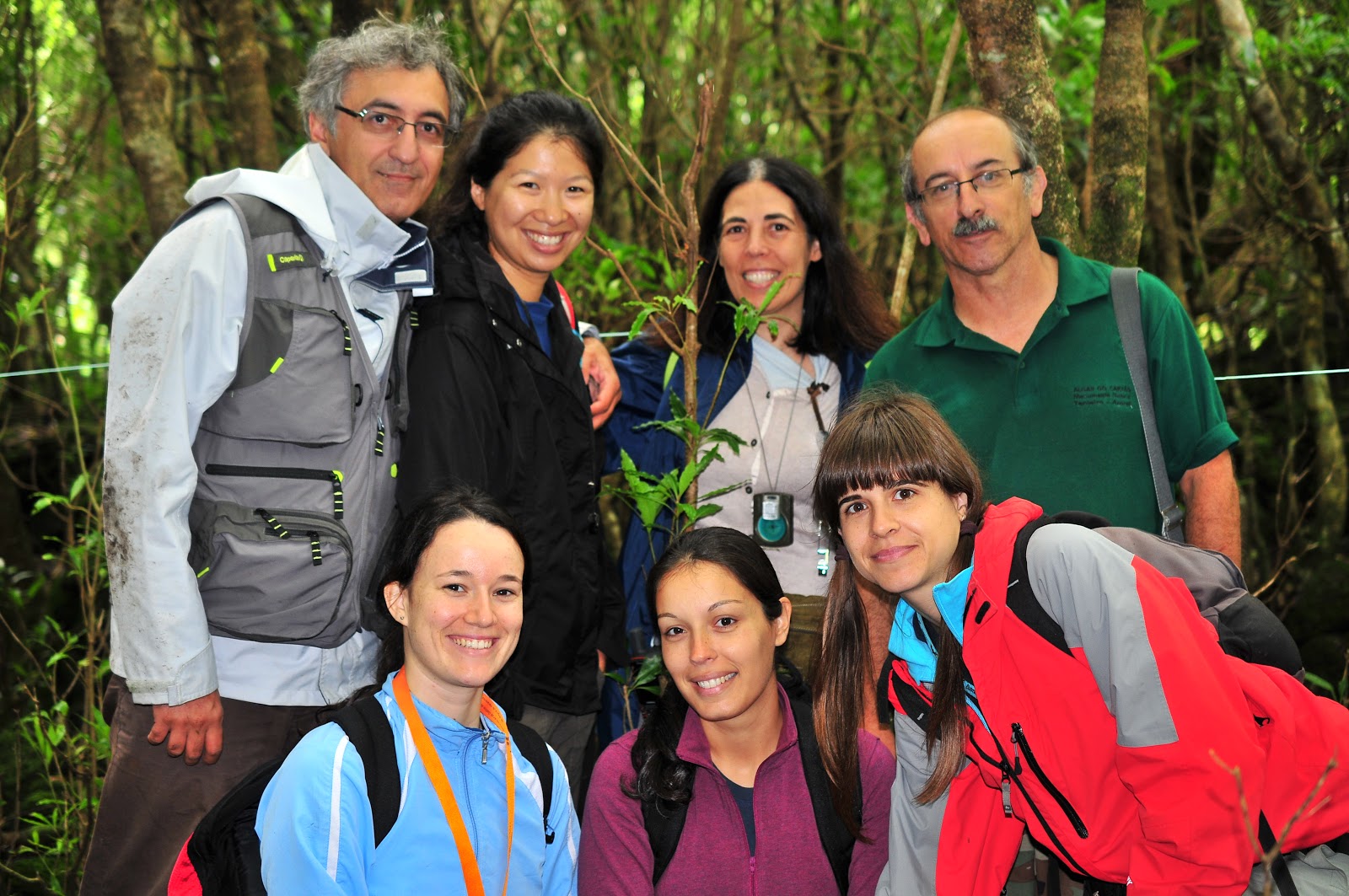
With another
six attendees we embarked on a two day- post conference field trip with John
Delay (PhD student at the University of Hawaii). We had the opportunity to
visit and learn more about the different habitats on Big Island (Kipukas, lava
tubes, Akaka waterfalls…).
Pix: the crew of the post conference field trip
Pix: Waipi'o coast
Pix: Akaka falls
Pix: Acacia koa, closest relative is Acacia heterophylla in Réunion island.
Pix: Metrosideros polymorpha, endemic pioneer tree on lava flows
Pix: Current eruption at Mauna Loa volcano
I feel very
lucky to have the opportunity to take part to this symposium and wish to thank the organizing committee for the excellent job they did to assemble this
program, the time and energy they dedicated to make this symposium inspiring
and enriching.
For those
who would be interested to learn more, the proceedings of this symposium will
be featured in the journal of Arctic, Antarctic and Alpine Research.
Mahalo!
Claudine
Ah-Peng